


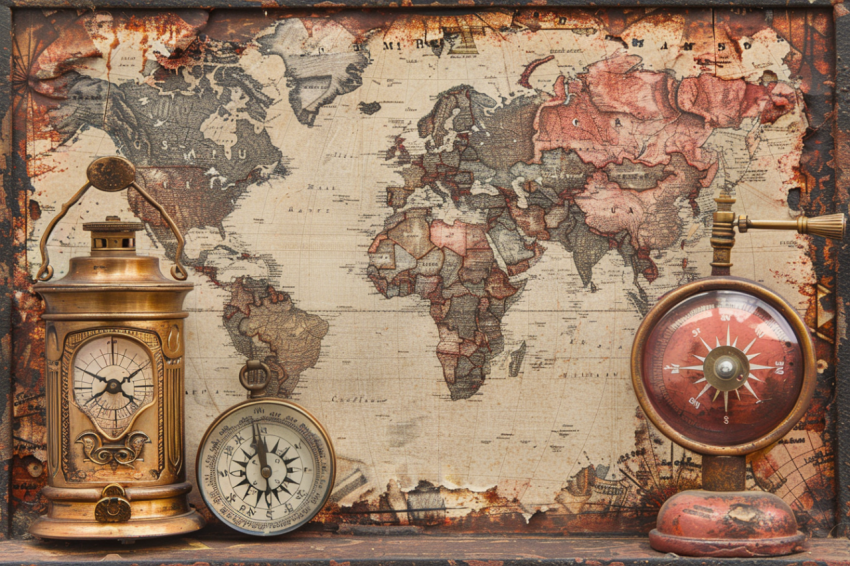
Decoding the World: The Power and Evolution of Maps Through History
A map is a symbolic representation of an area, typically a geographical region, showing its features and their relationships to each other, usually drawn on a flat surface. Maps are powerful tools that have been used for centuries to navigate, understand, and communicate information about the world around us. They are essential for a wide range of activities, from planning a road trip to analyzing global climate patterns. This exploration delves into the multifaceted world of maps, examining their rich history, diverse types, essential elements, the evolution of mapmaking technologies, and their profound impact on society and our understanding of the world.
1. History of Mapmaking (Cartography):
- Ancient Maps: The earliest known maps date back to ancient civilizations, including the Babylonians, Egyptians, Greeks, and Romans. These maps were often based on limited geographical knowledge and were sometimes intertwined with mythology and religious beliefs.
- Babylonian Map of the World (c. 600 BCE): A clay tablet depicting the world as a flat disc surrounded by water.
- Anaximander (c. 610-546 BCE): A Greek philosopher credited with creating one of the first maps of the known world.
- Ptolemy (c. 100-170 CE): A Greco-Roman astronomer and geographer whose Geographia included a world map and a system of coordinates that influenced cartography for centuries.
- Medieval Maps: During the Middle Ages in Europe, mapmaking was often influenced by religious cosmology.
- T and O Maps: Simplified world maps representing the three known continents (Asia, Europe, and Africa) arranged in a T-shape within a circle (O), often with Jerusalem at the center.
- Portolan Charts: Navigational charts used by sailors in the Mediterranean, featuring coastlines, harbors, and rhumb lines (lines of constant compass bearing).
- Age of Exploration (15th-17th Centuries): European exploration led to significant advances in cartography, with more accurate maps being produced to aid navigation and document newly discovered lands.
- Mercator Projection: A map projection developed by Gerardus Mercator in 1569 that became the standard for nautical charts because it represented lines of constant compass bearing as straight lines.
- Scientific Revolution and Enlightenment: Advances in surveying, mathematics, and astronomy further improved the accuracy and detail of maps.
- 19th and 20th Centuries: The development of new technologies, such as aerial photography, remote sensing, and computer mapping, revolutionized cartography.
- Modern Cartography (Digital Age): The advent of computers, Geographic Information Systems (GIS), and satellite imagery has transformed mapmaking, leading to interactive maps, digital globes, and sophisticated spatial analysis tools.
2. Types of Maps:
Maps can be classified based on their purpose, scale, and the type of information they display:
- General Reference Maps: Show a variety of features, such as roads, cities, rivers, and political boundaries. Examples include road maps, atlas maps, and topographic maps.
- Thematic Maps: Focus on a specific theme or topic, such as population density, climate, vegetation, or economic activity.
- Choropleth Maps: Use color shading to represent data values within defined areas.
- Dot Distribution Maps: Use dots to represent the location and density of a phenomenon.
- Isoline Maps: Use lines to connect points of equal value, such as contour lines (elevation), isotherms (temperature), and isobars (pressure).
- Flow Maps: Show the movement of people, goods, or ideas between places using lines or arrows.
- Topographic Maps: Show the shape and elevation of the Earth's surface using contour lines.
- Nautical Charts: Maps specifically designed for marine navigation, showing water depths, coastlines, hazards, and aids to navigation.
- Aeronautical Charts: Maps used for air navigation, showing airports, airways, and other information relevant to pilots.
- Cadastral Maps: Show property boundaries and land ownership.
- Political Maps: Focus on showing governmental boundaries.
- Physical Maps: Illustrate the physical features of an area, like mountains.
3. Essential Elements of a Map:
- Title: Describes the subject and purpose of the map.
- Scale: Indicates the relationship between distances on the map and corresponding distances on the ground. It can be expressed as a ratio (e.g., 1:24,000), a verbal scale (e.g., "1 inch equals 1 mile"), or a graphic scale (a bar showing distances).
- Legend (Key): Explains the symbols, colors, and patterns used on the map.
- Compass Rose (or North Arrow): Indicates the direction of north on the map.
- Grid: A system of lines used to locate points on the map, such as latitude and longitude or a ইউনিভার্সাল ট্রান্সভার্স মারকেটর (UTM) grid.
- Projection: The method used to represent the curved surface of the Earth on a flat map. Different projections distort the Earth's surface in different ways, affecting the shape, area, distance, and direction of features.
- Author/Publisher: The person or organization who created the map.
- Date of Publication: When the map was made or last updated.
4. Map Projections:
A map projection is a systematic transformation of the latitudes and longitudes of locations from the surface of a sphere or an ellipsoid 1 into locations on a plane. All map projections distort the surface in some way. 1. www.msenvision.co.uk
www.msenvision.co.uk
- Conformal Projections: Preserve shape but distort area. (Example: Mercator Projection)
- Equal-Area Projections: Preserve area but distort shape. (Example: Mollweide Projection)
- Equidistant Projections: Maintain accurate distances from a central point or along specific lines.
- Azimuthal Projections: Preserve direction from a central point.
5. Map Scale:
- Large-Scale Maps: Show a small area in great detail (e.g., 1:10,000).
- Small-Scale Maps: Show a large area with less detail (e.g., 1:1,000,000).
6. Mapmaking Technology and Techniques:
- Surveying: The process of measuring and mapping the Earth's surface.
- Cartography: The art and science of making maps.
- Remote Sensing: Acquiring information about the Earth's surface from a distance, typically using satellites or aircraft.
- Satellite Imagery: Images of the Earth taken from satellites, providing a detailed and up-to-date view of the planet's surface.
- Aerial Photography: Photographs taken from aircraft, used for mapping and other applications.
- Geographic Information Systems (GIS): Computer systems for capturing, storing, analyzing, managing, and displaying geographically referenced information. GIS has revolutionized mapmaking and spatial analysis.
- Global Positioning System (GPS): A satellite-based navigation system that provides precise location information anywhere on Earth.
- Digital Mapping: Creating and using maps in digital formats, allowing for interactive features, dynamic updates, and integration with other data sources.
7. Uses of Maps:
Maps are used for a wide range of purposes, including:
- Navigation: Finding one's way from one place to another (e.g., road maps, nautical charts, aeronautical charts).
- Planning: Designing cities, infrastructure, and land use.
- Resource Management: Mapping and managing natural resources, such as forests, water, and minerals.
- Environmental Monitoring: Tracking changes in the environment, such as deforestation, pollution, and climate change.
- Education: Teaching geography, history, and other subjects.
- Research: Analyzing spatial patterns and relationships in various fields, such as epidemiology, sociology, and economics.
- Military Applications: Planning military operations and intelligence gathering.
- Disaster Response: Mapping affected areas and coordinating relief efforts during emergencies.
- Recreation: Hiking, biking, and other outdoor activities.
8. The Impact of Maps on Society:
Maps have had a profound impact on how we understand and interact with the world:
- Shaping Perceptions of the World: Maps influence our mental image of the world and our place in it.
- Facilitating Exploration and Discovery: Maps have been essential tools for exploration, navigation, and the expansion of human knowledge.
- Promoting Trade and Commerce: Maps facilitate trade by providing information about transportation routes and resources.
- Supporting Governance and Administration: Maps are used to define political boundaries, manage land, and plan infrastructure.
- Influencing Political Power: Maps can be used to assert territorial claims, promote national identity, and project power.
- Maps Can Be Biased: The choices made in their creation can reflect cultural, political, or social biases.
9. The Future of Maps: Maps continue to evolve with advancements in technology. Real-time mapping, 3D mapping, virtual reality, and augmented reality are changing the way we create and use maps.
Conclusion:
Maps are powerful tools that have shaped human history and continue to play a vital role in our lives. From ancient clay tablets to interactive digital globes, maps have evolved alongside our understanding of the world. They provide a visual language for representing spatial information, enabling us to navigate, plan, analyze, and communicate about the places we inhabit. As technology continues to advance, maps will undoubtedly become even more sophisticated, dynamic, and integrated into our daily lives, offering new ways to explore, understand, and interact with the world around us.
Map, Cartography, Mapmaking, Map History, Map Types, General Reference Map, Thematic Map, Topographic Map, Nautical Chart, Aeronautical Chart, Cadastral Map, Political Map, Physical Map, Map Elements, Map Title, Map Scale, Map Legend, Map Key, Compass Rose, North Arrow, Map Grid, Map Projection, Mercator Projection, Mollweide Projection, Latitude, Longitude, Coordinates, Surveying, Remote Sensing, Satellite Imagery, Aerial Photography, Geographic Information Systems (GIS), Global Positioning System (GPS), Digital Mapping, Interactive Maps, Online Maps, Google Maps, MapQuest, OpenStreetMap, Map Scale, Large-Scale Map, Small-Scale Map, Map Reading, Map Interpretation, Map Analysis, Map Symbols, Map Colors, Map Design, Map Projections and Distortions, History of Cartography, Babylonian Map of the World, Ptolemy's Geographia, Portolan Charts, Age of Exploration, Map Navigation, Map Use, Map Applications, Navigation, Planning, Resource Management, Environmental Monitoring, Education, Research, Military Applications, Disaster Response, Recreation, Mental Map, Cognitive Map, Spatial Thinking, Spatial Reasoning, Map Literacy, Map Skills, Map Bias, Map Ethics, Map Accuracy, Map Reliability, Map Validity, Map Update, Map Revision, Map Data, Spatial Data, Geographic Data, Geodata, Geospatial Technology, Location-Based Services, Wayfinding, Route Planning, Map Symbols and Conventions, Map Art, Map Design Principles, Choropleth Map, Dot Distribution Map, Isoline Map, Flow Map, Cartogram, Mental Map, Sketch Map, Map Collection, Map Library, Historical Maps, Antique Maps, Map Conservation, Map Restoration, Map Reproduction, Map Digitization, Web Mapping, Mobile Mapping, GPS Navigation, GPS Tracking, GIS Software, ArcGIS, QGIS, Mapbox, Google Earth, Virtual Globes, 3D Maps, Real-Time Mapping, Augmented Reality Maps, Virtual Reality Maps, The Future of Maps, Map Projections Explained, How to Read a Map, How to Use a Compass, Map and Compass Navigation, Orienteering, Map Symbols Quiz, Map Games, Map Activities, Map Puzzles, Map Coloring Pages, Map for Kids, Map for Students, Map for Teachers, Map Resources, Map Websites, Map Blogs, Map Videos, Map Tutorials, Map Courses, Map Workshops, Map Conferences, Map Organizations, International Cartographic Association (ICA), National Geographic Society, United States Geological Survey (USGS), Ordnance Survey, Mapping and Charting, Geodesy, Geomatics, Surveying and Mapping, Spatial Analysis Techniques, GIS Applications, Remote Sensing Applications, Cartographic Design Principles, Map Visualization, Data Visualization, Infographics, Map Aesthetics, Map User Experience, Map Accessibility, Map Copyright, Map Licensing, Open Source Mapping, Crowdsourced Mapping, Volunteered Geographic Information (VGI), Citizen Science Mapping, Map Censorship, Map Propaganda, Geopolitics and Maps, The Power of Maps, Maps and Society, Maps and Culture, Maps and History, Maps and Technology, Maps and the Future, Maps and the Environment, Maps and Sustainability, Maps and Climate Change, Maps and Urban Planning, Maps and Transportation, Maps and Health, Maps and Education, Maps and Business, Maps and Marketing, Maps and Tourism, Maps and Storytelling.